How to Convert GIS Data Into High-Quality Large Format Prints

Converting GIS data into high-quality large-format prints is critical in effectively communicating spatial information. Whether it's creating maps, posters, or visualisations, accurate and vividly aesthetic representations of GIS data are essential. They facilitate meaningful discussions about geospatial observations and patterns in the GIS and topographic industry.
This article will explore the entire process of transforming GIS data into detailed large-format prints. These documents can empower GIS professionals and topographers to use their GIS data for meaningful analysis. From preparing the data to selecting the right printer and optimising print settings, a comprehensive breakdown of each important step in the conversion process will be discussed in detail.
Why Convert GIS Data Into High-Quality Large-Format Prints?
Geographic information systems (GIS) produce data that experts use in the real world - often for large-scale projects like land development, architecture, and city planning. High-quality and large-scale prints are essential to many workflows. So being able to create them with large-scale printing is a must.
The Link Between Quality GIS Data Output, Communication, and Decision-Making
GIS documents can inform decision-makers and help coordinate teams. Sometimes, they are the reference point for multiple teams working together. The accuracy of the GIS document can determine the accuracy of both decisions and coordinated work.
Understanding GIS Data Conversion
GIS documents are created by combining hundreds to thousands of data points layered into a single document. However, printers require image file types. Therefore, data conversion in GIS becomes an essential part of the process.
Converting GIS Data Into Printable Formats
GIS data must be compressed into a printable format. But that doesn't mean you have to lose detail or accuracy. Large-scale printers typically have the internal storage to handle very large, detailed, printable files.
Common File Formats
Used in GIS Compatibility With Large Format Printers The best file types for GIS printing are vector-based. This means they are lossless when scaled. File format options include:
- PNG
- SVG
- PSD
GIS Software and Tools in Preparing Data for Print
Several software options can be used in preparing GIS data for print—some GIS-specific and some for highly detailed image editing. Be sure the software you use can handle your mass of data without loss and output accurate vector graphics.
Preparing GIS Data for Print
What to Consider When Preparing GIS Data for Large Format Prints
When preparing GIS data for large format printing, you will need to prepare clear visual images that come out in a single printable layer, even if your original design document is a multi-layered mass of data. Consider data cleanup, projection adjustment, and scale adjustments when preparing for print.
Data Cleanup
Determine the exact data to be shown and make sure that data points do not create obscure messaging in your final print.
Projection Adjustments
If there are intentional map distortions, then make sure they are consistent across the document to convey the details necessary for your project.
Scale Adjustments
Scaling GIS data for printing is a critical stage that must be done either before converting your data to a printable form or with vector graphics that scale losslessly after file conversion.
Data Simplification and Generalisation for Improved Print Quality
It may be necessary to simplify and generalise your data to make clearer prints and achieve higher print quality. Too many points will create overlapping indicators that can reduce the clarity of your documents.
Selecting the Right Large Format Printer
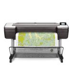
The right printer is essential for large-format printing of GIS data. The printer must be able to hold the full size and detail of the document and print with extreme accuracy to provide the best quality print. Large Format Printers Suitable for GIS Data Prints Not all large-format printers have the specs necessary for GIS data or the available paper sizes to meet your needs. Large-format printers must be chosen based on the largest size and highest data quality you will need to print for future projects.
Printer Specifications and Capabilities Required
Printers for GIS large-format documents must have at least 150 dpi, and 300 dpi (dots per inch) is even better. You also need printers with a great deal of internal memory that can hold the large and highly detailed files that you need to print. The ability to handle tiling may also be essential to piece together even larger-sized maps.
Selecting a Printer That Can Handle GIS Data
It is always a good idea to consult printer manufacturers like HP to identify a large format printer that has what it takes to handle the demands of your GIS data.
Optimising Print Settings on a Large Format Printer
Print Settings That Produce Optimal GIS Data Printouts
If your desired GIS map size is bigger than the paper available, you can use tiling or 'poster' settings on your printer. Leave a margin on each page or allow for overlap so you can reconstruct the tiled map with a margin for error.
The Best Print Mode, Paper Type, and Ink Settings for GIS Data Output
Each printer will have specific settings available that will help increase the quality of your GIS data prints. Set your printer to the highest dpi and use the right combination of ink and paper for highly accurate details.
Quality Control and Proofing Prior to Printing Large Format GIS Data
Top Methods for Quality Control Prior to Large Format Printing Quality control depends on:
- Clear and simplified data
- Careful scaling of the map details, key, and indicators
- Test printing
Ensuring Data Accuracy, Visual Clarity, and Overall Print Quality
Simplify your data. Focus on visual clarity, and don't hesitate to use more than one map if you need to represent multiple layers of data. Some even print on sheer drafting pages to allow layer-by-layer overlays. Optimise your markups and keys and convert the whole document into a vector file type before test printing.
The Importance of Test Prints and Proofing
Test printing ensures that your final map is up to your quality standards. Printing a single tile can help you assess if the data is conveyed clearly enough and if the notations meet your needs.
Post-Printing Considerations About GIS Data Prints
How to Maintain GIS Data Prints' Durability and Longevity
Once your GIS document is fully printed, you will likely need it for active use. Large-form GIS printings tend to require protection so they can be used throughout a project but are more difficult to protect due to their large size. You will need to make sure a one-sheet or tiled map is kept flat and protected.
How to Protect and Best Showcase Your Large Format Prints
There are several possible methods to protect your prints.
Lamination
When you have a large enough laminator, you can machine-laminate your GIS print. This will seal two thin sheets of plastic over and around your GIS document, making it safe to pass around and actively use in a busy work site.
Mounting
You can mount your GIS map onto a board, giving it the durability and mobility of rigid backing. You can even seal over the mounted document with a sheet of plastic for safekeeping.
Framing
Place your GIS document in a glass-fronted frame. This can be useful for hanging a large-format map on the wall or even turning it into a live tabletop for better collaborative planning.
Troubleshooting Issues When Converting GIS Data into Large Format Prints Common
Issues Converting GIS Data Into Print Output
GIS printing sometimes requires a little troubleshooting to ensure that the maps come out with the quality, clarity, and utility that you require. Here are a few common issues and how to solve them.
Colour Inconsistencies
The colours on your screen and the colours achieved by a printer are not always the same. A more versatile printer with a wide colour range is ideal, but you may need to calibrate your printer settings to get the best results.
Artifacts
Artifacts can be flaws in the data image created during scaling or file conversion. Scale carefully and always ensure that your data points and key/notations have been translated into a printable format correctly.
Printing Errors
Printing errors can happen. Misalignment of the image to the paper, ink spots, dry ink cartridges, and memory buffer errors can occur. This is where test prints and settings adjustments come in handy.
Solutions and Tips to Achieve the Desired Print Quality
You can get the best quality GIS large-format prints by learning your printer and exploring the printer features with the help of a professional who understands all the printer settings and how each can impact the high-detail quality of your GIS printed documents.
Reach Out to PSW to Receive GIS Map Printing Solutions our HP printer experts will be happy to help you find the best high-quality plotter printer to create your large-scale GIS maps and documents.


